
[responsive-slider id=2165]
A potential tropical cyclone could bring gusty wind and periods of heavy rain to much of Florida, including possibly West Volusia, this weekend.
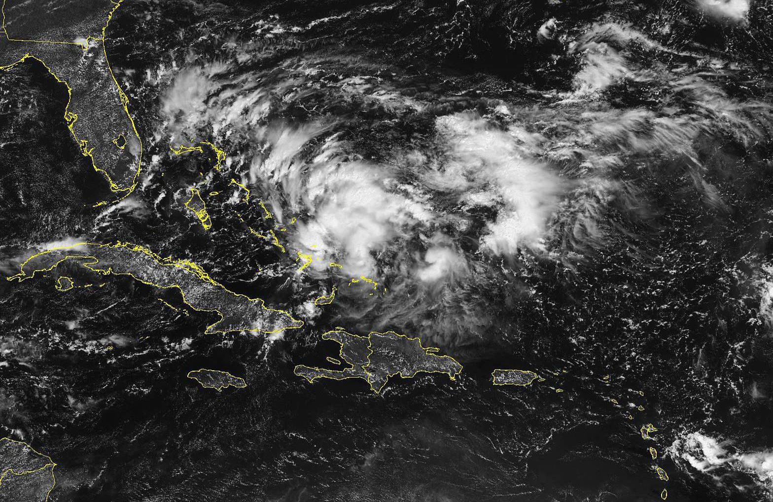
As of 8 a.m. Thursday, the National Hurricane Center gave an area of disturbed weather just southeast of the Bahamas a 70-percent chance of forming into a tropical storm within the next two days.
If the system manages to form into a tropical storm, it would be dubbed Humberto.
Regardless of whether the system forms into a proper cyclone, it is expected to cause a wet and windy weekend throughout much of Florida.
“The axis of the approaching tropical disturbance should reach Andros Island in the Bahamas Friday morning, and begin to spread deeper moisture from the Atlantic across east central Florida through the afternoon,” the National Weather Service’s forecast office in Melbourne wrote in a Thursday-morning forecast discussion. “A tightening pressure gradient will bring breezy/gusty conditions, with numerous showers and isolated lightning storms moving onshore.”
Rough surf and beach erosion are also expected along Florida’s east-coast beaches throughout the coming days.
The forecast office said models currently disagree where exactly the storm will head this weekend, with some taking it into the eastern Gulf of Mexico and others keeping it closer to the Florida east coast.
If nothing else, the system is expected to bring a respite from the recent heat in the area. The rain and clouds the system is expected to bring will keep temperatures in the 80s.
Visit www.nhc.noaa.gov for the latest information on tropical cyclones, and www.weather.gov/mlb for official NWS forecasts for our area.
— Anthony DeFeo

